Why storm damage happens in Vernalis
The Vernalis houses on record are old, and several are two storeys, so a storm-opened roof here is a high one. The County's parcel roll gives a building year for six houses touching the community: 1914, 1923, 1940, 1941, 1948 and 1959. Three of the six are two-storey. Houses of that age have had decades of weather, and a lost roof section or a limb strike opens the rooms below. On a residential roof over 6 feet up, the tarp goes on under Title 8 section 1731 fall protection.
Vernalis is mostly farmland, and farm buildings meet the wind across open ground. The General Plan counts 73.8 of the community's 142 acres in agriculture and describes active, large-scale farming on prime soils all around it. Along S Welty Road parcels range from about 5.7 acres to 139, and the biggest is under a Williamson Act contract. A gust works under the eaves and ridge caps of any barn, shop or shed out here and gets beneath open-sided structures, so damage is photographed and closed before the next rain.
Vernalis has no drainage system, and in a wet winter an opened roof takes rain until it is covered. The County's checklist marks storm drainage by ditches and ponds, with no drainage system, curbs or gutters. February's 2.57-inch normal at Tracy Carbona, the closest station with 1991-2020 normals, tops a December-to-February wet stretch. A tarp fastened in December has to hold through that run of storms.
The warehouse and commercial parcels by the Route 132 junction bring a different kind of building to Vernalis. The General Plan counts about 12 acres of industrial use, on land zoned Warehouse Industrial, and 0.8 acres of commercial use at the corner where Routes 132 and 33 meet. No record read describes those buildings, so the make-safe starts by photographing what the wind opened and how the building is built. A door forced open on a warehouse is closed, and a lifted warehouse roof is tarped until a new commercial roof goes on.
No storm on record is located at Vernalis, but the 2022-23 disaster declarations covered its county. NOAA's storm event database places nothing at Vernalis in the three decades from 1996. The CNRFC summary for late December 2022 to mid-January 2023 counts 5 to 8 inches of valley rain for the area that takes in San Joaquin County, with trees and lines down. San Joaquin County is named under both the emergency and the major disaster declaration on the Cal OES list.
In the January 2023 storms, 16 roads were closed on the Westside, from the northernmost reaches of Vernalis to Newman. When storms close roads in and around the community, the run to an opened roof stretches toward the far end of the window.
Storm damage repair, as delivered in Vernalis
From the Modesto base the crew drives 16 road miles west on Route 132 to where it meets State Route 33. Each visit is added to one make-safe log, with the boards, tarps and photos in the order they were done.
Route 132 brings the crew west to the Vernalis junction, where Caltrans counts 16,600 to 17,600 vehicles a day. San Joaquin County's hazard plan warns of thick winter tule fog on its roads, and with harvest trucks that can push arrival toward 120 minutes. Naming the gate on SR 33 or S Welty Road helps.
No one works under a limb that is still hanging or goes near a line resting on the house, an outbuilding or the tree. Cutting within 10 feet of a high-voltage line waits until the utility has cleared the line.
Before anything is moved or thrown away, the damage is photographed and filmed inside and out, as FEMA advises, and calls with the insurer are logged.
A tree or limb on a Vernalis house or outbuilding comes off under a qualified tree worker, with nobody beneath it.
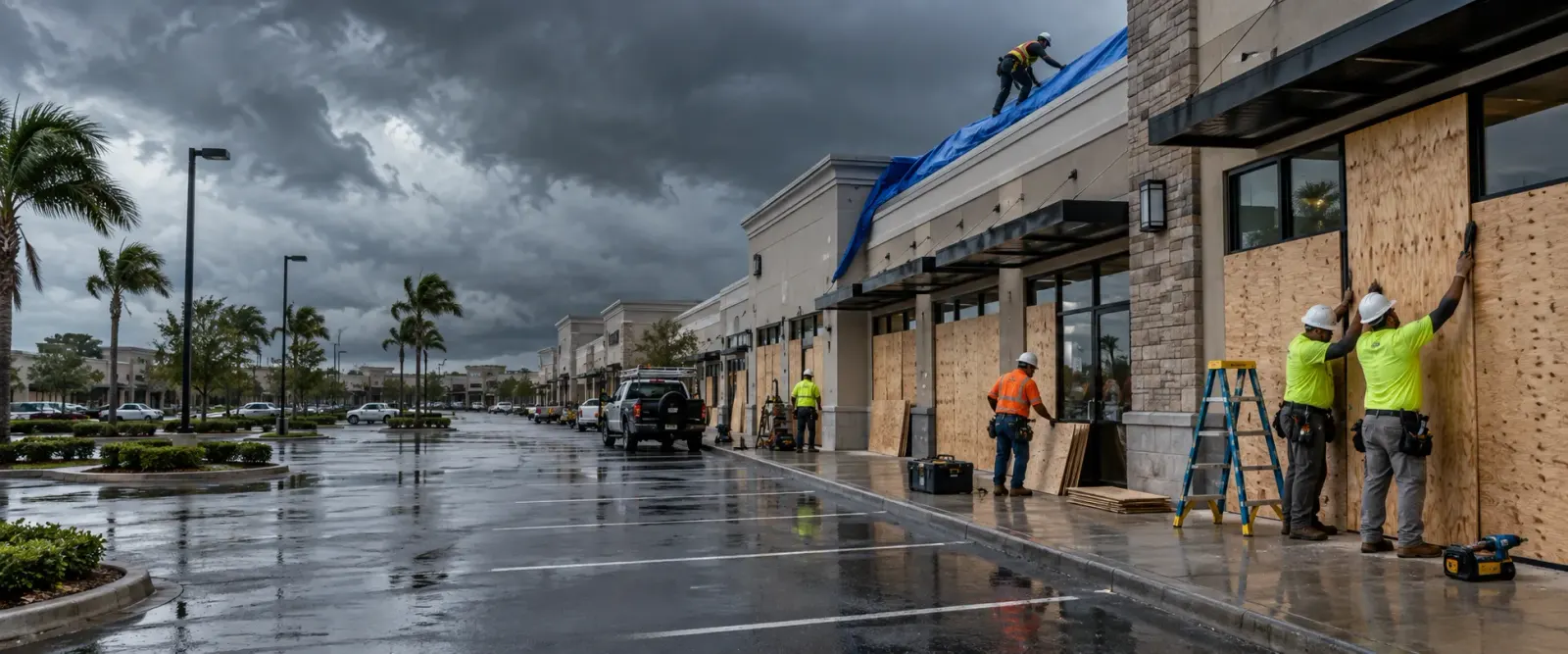
Openings in house and outbuilding roofs are tarped and fastened with Title 8 fall protection, and broken windows and doors take plywood. Plastic sheeting and plywood are the temporary repairs the Department of Insurance guide names.
Rain that has already wetted ceilings, walls or floors goes to water damage restoration that day.
Receipts are kept for the adjuster. San Joaquin County's Building Division on East Hazelton Avenue permits the repair on its side of the line, Stanislaus County's Modesto counter on the other.
Where storm damage happens in Vernalis
Vernalis is 142 acres of farmland, old houses and a few commercial and warehouse parcels astride a county line.
SR 132 and SR 33 junction, Rural Service Commercial corner
Where Caltrans names two count points Vernalis and Route 132 carries up to 17,600 vehicles a day, on land zoned Rural Service Commercial. No record read describes the buildings on it, so wind damage is recorded as found.
State Route 33 frontage homes
The addressed houses along the highway, recorded as built in 1914, 1923, 1941, 1948 and 1959, three of them two-storey. Tarps on these older, taller roofs go on with fall protection.
S Welty Road
The second addressed street, where a house recorded as built in 1940 stands among large farm parcels. Outbuildings on parcels this size are checked for panels the wind has loosened.
Warehouse Industrial parcels
The General Plan's count puts industrial use at about 12 acres, on land zoned Warehouse Industrial. Its buildings are not described in any record read, so each is photographed and its openings closed as found.
Sacramento Northern Railroad corridor and the old train stop
The former Southern Pacific line, now the Sacramento Northern, where Vernalis began as an 1880s stop with a few stores and a post office. Buildings beside the line are photographed and made safe from the road side.
Stanislaus County side and the Vernalis General Store
The part of the settlement across the county line, where the General Plan places the Vernalis General Store. Permits for a repair on this side come from Stanislaus County at 1010 10th Street, Modesto.
Farmland ring, Vernalis clay loam and Capay clay
Agriculture covers 67 percent of the community, surrounded by large-scale farming on prime soils, where the World War II camp site was later planted as an almond orchard, since removed. Any farm building here stands in open-field wind.
San Joaquin River gauge reach
About 3.3 miles north-north-east is the Vernalis river gauge, whose record crest was 34.88 feet in January 1997. River water is a separate loss from storm damage, and the two are photographed apart.
Storm damage sub-services available in Vernalis
Questions from Vernalis property owners and managers
It depends on the side. For the San Joaquin side, plan review, permits and inspections come from that county's Building Division at 1810 E. Hazelton Avenue, Stockton. Part of the settlement, including the Vernalis General Store, lies in Stanislaus County, where the building permit counter is at 1010 10th Street, Suite 3400, Modesto, and a rebuild needs a permit as new work does. Boards and tarps go on first either way.
With fall protection. Cal/OSHA Title 8 section 1731 requires it on residential-type roofing work over 6 feet on slopes up to 7 in 12, and at any height on steeper roofs. The tarp is laid over the opening, fastened so the next gust does not lift it, and photographed. A two-storey house also means rain can pass through the upper floor into rooms below, so ceilings downstairs are checked too.
Only the openings are. Storm water in Vernalis runs to ditches and ponds, and when they fill it can stand beside a building. Storm damage repair closes the roof and walls and records the damage. Water that has already come inside, through the roof or at the floor, goes to water damage restoration. The first photos show which water came from where, so the adjuster sees each loss apart.
The area is closed off first, because a limb still hanging can move and a trunk under tension can react when it is cut. If a line is caught in the tree, nothing within 10 feet of a high-voltage line is touched until the utility clears it. The tree and the damage are photographed where they lie. Then the part on the house is taken off under a qualified tree worker, and the opening is tarped, with the fallen limbs left for the debris haul.
No. The Department of Insurance's residential claims guide puts temporary repairs first, to prevent further damage, and notes that a policy may not cover ensuing damage without reasonable steps. Where a full inspection cannot be done at once, it explains, the adjuster may scope the loss and come back later. FEMA's advice is to consult your adjuster or insurer before signing any cleaning, remediation or maintenance agreement, so tell them early.
Safety and photos come before either. After that, the order follows the damage: an open roof over rooms that are still in use is covered first, and a door or window that leaves the house or a warehouse open to entry is boarded next. Each step goes into the make-safe log with its time and photo, so the adjuster can follow it.
Storm damage repair near Vernalis

