Why storm damage happens in Lathrop
More than 88 percent of Lathrop's rain falls from November to April, in a rainy season that runs from late October into May. The City's water plan puts the area's average at 12.2 inches and notes that dense tule fog can settle in its mild winters. From late December 2022 to mid-January 2023, ten atmospheric rivers and a bomb cyclone crossed the region, the CNRFC records, bringing trees and power lines down, and San Joaquin County was named in the declarations that followed.
Lathrop's industrial parks are sized for the freeway, with roofs and doors to match. South of SR 120, the TriPoint Logistics Center that grew out of the South Lathrop plan is laid out for 4.85 million square feet of warehouses, one of them a 1.2 million sq ft building for Wayfair, while Crossroads Industrial Park spreads over roughly 528 acres at the I-5 interchange. Over a span that long, a seam opened in wind wets insulation across a large floor, and a dock or roll-up door pulled from its track leaves the building standing open.
East of I-5, Lathrop's older blocks already need the repairs a storm finds: roofs, windows and siding. The Housing Element names the streets from 5th to 7th between Lathrop Road and O Street, and the area between Warren Avenue and West Lathrop Road, as pockets whose older houses tend to need a moderate repair or two, often a new roof, windows or siding, and where the streets have no curbs, gutters or sidewalks. Worn roofing lifts first in a gust, and a cracked window lets the rain straight in.
Lathrop counted 381 mobile homes on 1 January 2022, and five parks lie along Harlan Road, Louise Avenue and Mossdale Road. The largest, Camino Real Mobile Estates, has 167 spaces, and the Housing Element targets investment at parks and multifamily buildings more than 20 years old. In a park, one storm can open many homes at once, with residents to keep clear while sheeting and plywood go on, so the log records every space touched and each owner gets a separate set of photos.
In River Islands, a power line down after a storm is a Lathrop Irrigation District matter. The district supplies electricity to River Islands residents, as the City's severe weather page notes, and the first phase there is planned for 4,284 homes, with much of its area already built. Under Title 8 section 3423, no one trims within 10 feet of a high-voltage line unless qualified for line clearance, so any tree tangled in a line waits for the district before it comes off a house.
On 31 December 2022, Stockton Airport recorded 2.85 inches of rain, beating that date's record of 0.79 inches from 2005 and the wettest December day on its books, 2.38 inches on 22 December 1955. On a day like that, a wind-opened roof takes water for as long as it stays uncovered.
Storm damage repair, as delivered in Lathrop
The Modesto base sits 24 road miles away, and the crew comes in on SR 120 as far as I-5 at Mossdale. From the first photo to the repair scope, one log carries the whole job.
Arrival falls inside 90 to 120 minutes, day or night. I-5 at the SR 120 junction carried 152,000 vehicles a day in the 2024 count, and tule fog in the mild winters or harvest trucks push arrival toward two hours; the time is confirmed on acknowledgement.
Before work starts, the space below hanging limbs, torn siding or a loose panel is roped off and cleared of people, because broken limbs keep moving and trees under tension can spring when cut. A line on the tree or roof holds everything until the utility clears it.
Photos and video cover the roof, the walls, each room and each damaged item before anything moves or leaves the property, and each insurer call is logged.
The removal runs under a qualified tree worker; the tree's owner, and any line from the Lathrop Irrigation District or another utility, are noted first.
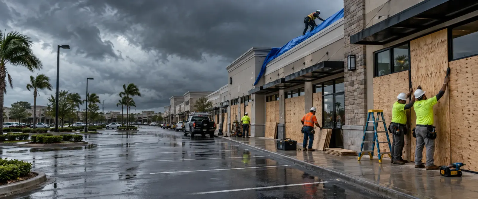
Torn roofs are tarped and fastened, and broken windows and doors are closed with plywood. Work on roofs follows Title 8 fall protection: section 1730 above 20 feet, section 1731 above 6 feet on residential-type roofing.
Wet ceilings, insulation or floors pass to water damage restoration in Lathrop.
The repair is scoped for the adjuster and permitted by the City's Building Department through its LCAP portal; floodplain work may also need a floodplain development permit.
Where storm damage happens in Lathrop
Lathrop's storm damage runs from older blocks east of I-5 and five mobile home parks to freeway warehouses and the levee-ringed new towns.
5th to 7th Street, Lathrop Road to O Street
Older houses east of I-5 on streets with no curbs, gutters or sidewalks, many already due for re-roofing, windows or siding. Worn roofs lift in gusts and are tarped.
Warren Avenue to West Lathrop Road, Harlan Road to Avon Avenue
An older neighbourhood running from Harlan Road across to the homes on Avon Avenue. Aging siding and windows give way in wind, and each opening is photographed before plywood covers it.
Harlan Road, Louise Avenue and Mossdale Road mobile home parks
Camino Real Mobile Estates, Walnut Grove, Lathrop Sands, Lathrop Mobile Home Park and Harlan Park. One storm can open many homes, so residents are kept clear and every space is logged.
Crossroads Industrial Park, I-5 and SR 120
Roughly 528 acres of industry above and east of the I-5 and SR 120 interchange, proposed in 1989 and inside the city from its first day. Wide roofs are tarped with fastened edges, and doors are secured before the crew leaves.
Sharpe depot and Roth Road
The Sharpe supply depot, 727 acres off Roth Road next to the rail intermodal yard, holds more of the planning area's recorded historic buildings than anywhere else. Storm openings on older buildings are photographed and covered one by one.
South Lathrop: Lathrop Gateway Business Park and TriPoint Logistics Center
Limited industrial land at Gateway and TriPoint's planned 4.85 million sq ft of distribution space south of SR 120. Big doors and long roof spans are the openings to secure after a storm.
Central Lathrop Specific Plan and Stanford Crossing
The plan area west of the freeway that holds the high school and the Generations Center, with 1,040 single-family lots mapped. In newer tracts wind takes fences, gutters and fascia first, and school roofs are tarped with fastened edges.
Mossdale Landing (Mossdale Village)
The Mossdale Village neighbourhood entitled for roughly 1,700 homes, between the freeway and the river's open space edge. Tract fences and landscape trees go over in wind on rain-softened ground and are photographed first.
Mossdale Landing East and South, the I-5 commercial frontage
Highway, village and service commercial along the freeway south of River Islands Parkway, with homes behind. Freeway signs and storefront glass are boarded and photographed after a storm.
River Islands Phase 1 (Stewart Tract, RD 2062)
Stewart Tract homes behind more than 13 miles of levee built or improved since 2005, with electricity from the Lathrop Irrigation District. A line down in a tree goes to the district first.
River Islands Phase 2 and the Paradise Cut edge
The second phase, approved in 2021 with a town center planned at Paradise Road, next to the setback levee on Paradise Cut. Homes finished and under construction on open ground get tarps fastened against the next gust.
Southeast Stewart Tract and RD 2107 (Dell'Osso Farms)
The part of Stewart Tract across the railroad, with Dell'Osso Farms, where the embankment splits RD 2062 from RD 2107. Farm and highway commercial buildings are tarped and boarded like any other.
Storm damage sub-services available in Lathrop
Questions from Lathrop property owners and managers
River Islands gets its electricity from the Lathrop Irrigation District, so the district hears about the line before anyone touches the tree. Keep everyone back from the line and anything it rests on. Under Cal/OSHA Title 8 section 3423, only qualified line-clearance trimmers work within 10 feet of a high-voltage line, so the tree comes off the house once the district has made the line safe.
Yes. Permits come from Lathrop's Building Department on Towne Centre Drive, and it takes applications only through the Lathrop Civic Access Portal. Remodeling, signs and electrical, mechanical and plumbing work all appear on its list of jobs that need one, and repairs are checked against the 2025 California Building Standards Code. Tarps and plywood keep the building closed while the scope for the permanent commercial roof replacement is prepared for the adjuster.
Yes, if the job is large enough. The City's September 2023 flood letter treats reconstruction, rehabilitation or an addition costing more than 50 percent of the structure's appraised or market value as a substantial improvement, and such work has to meet floodplain standards, such as raising the lowest floor and its equipment a foot or more over the 100-year flood level. Owners are told to get a floodplain development permit, a building permit or both where required.
Residents are kept clear while the damaged home is made safe. Openings are closed with sheeting or plywood, the roof is covered, and the home is photographed inside and out before anything is thrown away, as FEMA advises. Where one storm opens several homes in a park, each space is logged on its own for its owner and for the park, and clearing the panels left behind is storm and fire debris removal in Lathrop.
Covering the roof is a temporary repair, and the Department of Insurance guide asks policyholders to make those to prevent further damage, warning that ensuing damage may go uncovered if reasonable steps were not taken. An adjuster may call before any forms are filled in. FEMA's advice is to speak with the adjuster or insurer before signing any cleaning, remediation or maintenance agreement.
The tree where it fell and where it stood, the roof, siding and gutters it struck, the rooms below and every damaged belonging, all before anything is moved. FEMA asks for photos and video before items are discarded and for receipts from purchases and repairs, and the Department of Insurance guide suggests a log of every call and letter.
Storm damage repair near Lathrop

